Showing posts with label Washington State. Show all posts

Monday, April 14, 2014

La Conner - Tulip Tour by Bike

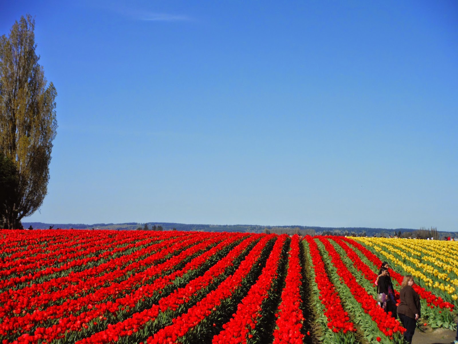
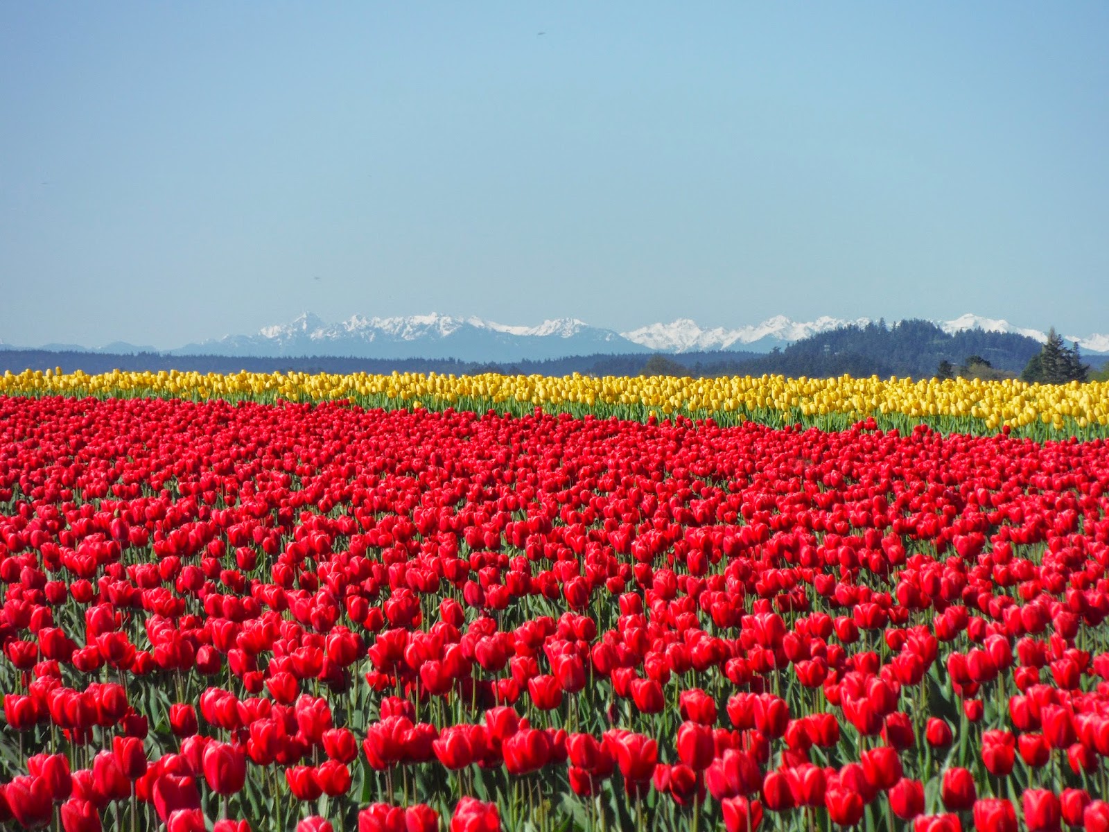
After paddling yesterday at Widgeon Creek, we had a really bad case of Spring Fever.  Nothing quite cures Spring Fever like a slow bike tour through the Daffodil and Tulip fields outside of La Conner in Washington State.  Words will not do it justice....so we will share the day via pictures.

Tiptoe through the tulips with us.....


Where's Waldo?  Look carefully!

Giggle of the day:

We imagined a peaceful,cycle in solitude through spectacular farmer fields.....we found everything BUT solitude!


Map and Route Tips:

Check the bloom map before you go:

..and be sure to check out the Skagit Valley Tulip Festival


Cyclists....need to be really careful.  Traffic can be extremely heavy....and the drivers and passengers are ALL looking at tulips NOT watching for cyclists.  Be defensive....for sure!

Sunday, February 16, 2014

Bike Centennial Trail Washington State

It was time to be back on the bikes and this weekend we decided to head south to the Centennial Trail in Washington State.  The trail is 29 miles long and runs from just north of Bryant to the City of Snohomish.  Another rails to trails initiative the trail is designed for walkers, runners, cyclists and horseback riding...and we saw them all.  A few brave in line skaters were even braving the rain!

Trail access at Arlington
We decided to jump on the trail at Arlington.  There are many access points to the trail, so it is easy to hop on and off to explore the many local shops, parks and family attractions.  Arlington is a wonderful little town and definitely a blast from the past.  American flags proudly flying and good old small town charm everywhere!  Of course, Seahawk pride and evidence of the 12th man is also everywhere!

Go Hawks

Rob will tell you that no day trip is a success unless you begin your day in the Ma and Pa diner.  And so, without a second thought we found ourselves enjoying omelettes at the BlueBird Cafe...family owned since 1958.

Just outside of Arlington the trail is under construction, so riders are forced to ride in traffic for a short distance.  We found the drivers to be very considerate, but as always were grateful to be back on designated trail away from traffic and noise.  The trail featured many scenic views and rest points.  We simply can't recommend this trail enough.  It is an easy ride, well maintained, great access points and lots of services along the entire length of the trail.  Truly a gem!


A view of the lake

Scenic boardwalk to the lake

Unfortunately we have not been on our bikes this winter as much as we would like so we must confess that we were not in the best shape for a 60 mile jaunt.  (Mind willing - body ain't!)  As the rain and wind picked up for the return journey our legs began to give out.  It really was a test, both mentally and physically to get back to the trail head.  We were both fighting leg cramps and bike butt and at times had to get off and walk.  On the bright side, the weather had turned so nasty that there was no one left on the trail to witness our walk of shame.

I think it is clearing up!
We trudged along, and were absolutely thrilled to return to our van at the Trail head parking lot.  We made a promise to ourselves to pick up our work-out schedule and return to the Centennial Trail in the summer....rumour has it the ice cream stores along the route are amazing!

Giggle of the Day:

One of the joys of rails to trails routes is it usually means FLAT, and generally the Centennial Trail is a very easy ride.  However, there is one section featuring a slow steady climb - 642 feet.  On the bright side, when you reach the top of the hill, you are made honourary members of the Robert M. Culpeper Blistering Saddles Cycling Team!

Not really a team you want to join

Free Library - now that is community in action!

...for those feeling a little thirsty


Map and Route Tips:

Centennial Trail

http://www.bikely.com/maps/bike-path/Centennial-Trail-Snohomish-County


Snow Shoe Mount Baker - Washington State

Many boast that one of the joys of living in the lower mainland area of British Columbia means that in the winter you have the opportunity to ski and play golf all in the same day.  Living here in the rain forest means that one often "forgets" about winter, as it never really feels like it.  (of course, our reference for defining winter is growing up in Alberta and Manitoba)  Well, this weekend we both craved WINTER.  Maybe the long hours on the couch watching our athletes compete in Sochi drew us to the mountains or maybe our recent cold snap reminded us of winter.  Whatever, the reason we decided to pack up our gear and head to Mount Baker in Washington State.


Creative Fencing at Glacier Ski Rentals

Yep...we were going in the right direction!

The only way to describe Baker is MAJESTIC.  The glacier covered peaks of Baker lie within Snoqualmie National Forest.   The following description is from the USA Forest Service website:


The most prominent feature of the Mt. Baker Wilderness  is the 10,781 foot [3,286 meters] active volcano from which the wilderness takes its name. Mt. Baker is the northernmost volcano in the United States Cascade Range located 15 miles south of the Canadian border. The mountain is perpetually snow-capped and mantled with an extensive network of creeping glaciers. Baker's summit, called Grant Peak, is actually a 1,300-foot-deep mound of ice, which hides a massive volcanic crater. Directly to the south is a smaller and younger crater, which is currently a center of periodic steam eruptions. Sherman Crater is only partially ice-filled and the rim's pinnacle, known as Sherman Peak, reaches an elevation of approximately 10,160 feet [3,097 meters].

Leaving the ski are boundary for the back country

We decided to start our day trip from the Mount Baker ski area.  We arrived to a full parking lot!  It was a winter wonderland and we were thrilled to see families skiing, snow-shoeing and sledding.  We made our way to the upper parking lot area, found the road up the mountain and entered the back country.  The snow was absolutely fantastic...quite a surprise as we had seen very little snow as we made our way up the mountain.  The weather conditions were not great, the light was flat and there was definitely a storm moving in.  We decided to not venture too far and chose to head to Artist Ridge in the Heather Meadows area.  This trail is well known for its many viewpoints - but today, was not the day to capture a view.  Visibility was really poor.  Despite the poor visibility we enjoyed bumping in to numerous winter enthusiasts and many snow hounds in search of fresh powder in the back country.  


Giggle of the Day:

We had a good giggle as we took note of how equipment has changed......


Map and Route tips:

Tuesday, September 17, 2013

Lummi Island Kayak - Over night trip

Summer has come and gone so quickly! We just couldn't accept the oncoming fall without at least one more overnight kayak trip.  There are so many wonderful opportunities to paddle in the Pacific North West that it was quite a tough decision to pick a location for our last overnight of the year.  We decided to paddle close to home and so chose an overnight trip to Lummi Island in Washington State.


Gooseberry Point Boat Launch
We launched from Gooseberry Point, on the Lummi First Nation land, adjacent to the Lummi Island ferry.  We arrived to find that the beach was a beehive of activity as fishermen tested their skill against the elusive salmon.  Numerous onlookers were being encouraged to throw rocks at the seals as the fishermen tried to pull in their nets.  The seals seemed undeterred at all efforts to divert their attention as they appeared to be appreciating the salmon smorgasbord being provided.

Hale Passage
To begin the paddle we crossed Hale Passage toward the east side of Lummi Island.  The passage is notorious for wind, waves and funky currents so we were grateful to have a smooth and uneventful crossing.

We paddled along the eastern shores and enjoyed peeking at the numerous ocean front cottages.  They are all unique, character homes....you know they have stories to tell about endless summers spent on the beach.  We stopped for lunch at Inati Bay, home of the Bellingham Yacht Club.  Several sail boats were anchored  in the cove and their crews were enjoying picnics and campfires on the beach.  The gang welcomed us to join the yacht club and encouraged us to attend the Friday evening potlucks!

Inati Bay


After lunch and visit with the folk at Inati Bay we continued on to the Department of Natural Resources marine campsite on the southern end of Lummi Island at Real Bay.  This site is part of the Cascadia Marine Trail.  We were absolutely thrilled with the campsite.....gentle beach landings, primitive campsites complete with fire rings and picnic tables and a skookum outhouse (toilet paper included).  Life is good!  We set up camp and settled in for dinner and a glass or two of wine on the beach.  As we watched the campfire burn down we chatted about the day and pondered what tomorrow would hold.

Lummi Island Marine Campsite

Bare feet, Barefoot Wine and a room with a view....a perfect combination.
On a side note, we must give credit to WAKE - the Whatcom Association of Kayak Enthusiasts.  We learned that DNR no longer maintained the campsite, and in order to avoid closure WAKE volunteers stepped up and now steward the area.  Thank you ...and great work!


We weren't alone as we prepared to launch at low tide


Giggle of the day:

We had a very disorganized start to the morning!  We crossed the border and were merrily travelling along Highway I-5 when I asked Rob if he had packed the tent.  He went white....a sure sign that he had NOT packed the tent.  I tried to remain calm, and suggested that maybe we could make due with the tarp. He then asked me if I had packed the life jackets and spray skirts.  I turned white....a sure sign that I had NOT packed the life jackets and spray skirts.  We grudgingly turned around, went back to the border crossing  convinced the border guards that we were not smugglers - just scatter brains and did a redo!

Day Two - WAKE campsite to Gooseberry Point

The marine weather forecast for the day was not good...heavy winds, rain and a potential thunder storm were in the works.  We definitely did not want to be crossing Hale Passage in those kinds of conditions so we decided to get an early start and attempt to beat the incoming weather.  We were on the water by 7:30am.  What a spooky morning.  The water was like glass, but the fog was so thick that we could barely see 30 feet in front of us.   There was a stillness and quiet that at first was unsettling, but we soon came to enjoy.  Steep, heavily forested cliffs make up the south end of the island...ideal for another day of great critter viewing.  As we made our way around the southern tip of the island we crossed an eddy line and were bounced around as the ocean played with our boats.

Heavy fog as we depart from the campsite


We continued along the west side of the island and enjoyed the view of the rocky headlands.  Unfortunately, the fog still had not lifted so we were unable to see the islands to the west.  About mid way up the island the geography changes quite dramatically and we travelled along sandy beaches and again had terrific views of the ocean front homes. 


We were intrigued to see two parallel rows of huge fishing boats side by side,  Each boat had a man standing high on the mast, almost appearing to be at watch.  We joked about a pending pirate battle and were waiting to hear battle cries.


As we approached the north end of the island the wind picked up...we were also going against the current, so needless to say we were working hard and not going very far.  We rounded the bend and then fought our way to Lane Spit.  We decided to cross the passage at Lane Spit and attempt to angle our way back to Gooseberry Point.  It was quite a paddle, and as with all Weiss vacations we also encountered rain.  We finally completed the crossing wet, exhausted and happy to be on solid ground.

The rain picks up as we continue across Hale Passage
Back on dry land

Giggle of the day:

As you know there are many hazards to be faced when playing in the great outdoors.  During this trip we had to face boomers and bombers and debated the dangers of both.  Let us explain:

Boomer:  a boomer is a large rock that lies in wait just below the water line.  If not careful, you can hit the boomer before you notice it is even there.  Sometimes they can cause considerable damage to your kayak.

Bomber:  likely note a technical term, but a term we use when referring to those naughty seabirds who appear to communicate and fly in formation over us....dropping their bombs!

We encountered both on this trip.....we will leave it to your imagination as to which one of us was boomed and which one of us was bombed!

A bomber lines up his target......and begins the approach!
Map and Route Tips:


DNR campsite, maintained by WAKE - GPS  N 48 39.525 W 122 36.852
Nautical chart:  NOAA Chart 18424


Monday, September 16, 2013

Larrabee State Park Kayak Day Trip

Although we are always seeking to find new routes, the day trip out of Larrabee State Park is one that we try and paddle each and every year.  It never disappoints!  The boat launch area is just outside historic Fairhaven, and one of our favourite breakfast spots -Skylark Hidden Cafe.  To access the state park you must follow Chuckanut Drive....one of the prettiest drives in the area, and even if you are not the least bit interested in paddling...you must drive the Chuckanut!

Mexico or Chuckanut Bay?
Incredible sandstone cliffs
This year the paddling gods were on our side as we arrived at the boat launch to find near perfect, well actually PERFECT conditions!   The water was calm, the sun was shining, and we had the boat launch to ourselves.  We excitedly loaded our gear and began to paddle out of the cove.

Boat Launch at low tide - Larrabee 

The water clarity and visibility was unbelievable.  It felt like we could see to the deep dark bottom of the sea.  Of course, we knew this meant that we were in for a full day of fantastic critter viewing!  We marvelled at the variety of life we saw:  water jellies, lions mane jelly, moon jellies, a variety of anemones, sand dollars,  barnacles, red rock crab, purple shore crab, bat stars, leather stars, sun stars, pacific blood star, purple star, sunflower star, giant pink star, Red Sea urchin, and many more we simply could not identify.  We are looking forward to the day that Emma, our aspiring marine biologist will help us correctly identify those we miss.

Underwater Starfish gathering
Jellies lead the way


Sand dollars

It was a very slow leisurely paddle as we explored the amazing sandstone cliffs.  The cliffs have been weathered and battered by wind, ocean and rain and as a result they are a visual feast of smoothly rounded shapes and intriguing patterns...curves, crevices, and holes!

Sand stone - sculpted by Mother Nature


After travelling along the sandstone cliffs, we crossed open water to visit a Nature Sanctuary.  This small island in Chuckanut Bay is a terrific spot to stop for snack and a stretch.  It is a protected area and home to many bird nesting sites.  We enjoyed some beach combing and tide pool viewing.

Coffee Break at the Nature Sanctuary

On our return trip we once again poked and plodded our way along the shoreline.  It is amazing how the ebb and flow of the tides can dramatically change your view and at times you feel like you are paddling a whole new stretch of water.   We found a wonderful secluded cove to land and scrambled up  the cliff to a fabulous picnic spot over looking the ocean.  The view was indescribable.  Reluctantly, we looked at the time and knew it was time to return to the boat launch and head home.  Thank you Larrabee for another awesome paddle....see you next year!

Lunch break with a view


Giggle of the day:

After lunch, as we paddled back to the boat launch, we noticed a creature in the water up ahead.  It looked like a seal, but there was something not quite right.  We paddled closer only to discover a new species....a DOG FISH.  Yes...here we were sandstone cliffs to our right and endless ocean to the left and a dog in front of us.  It was dog paddling like crazy and breathing heavily.  We were quite concerned, and tried to get closer to corral it to shore.  However, every time we drew near the dog would try to jump on board one of our kayaks.  It was quite a big, sturdy dog, and we were concerned that he would capsize one of us.  We managed to get him to rest on a paddle for a bit and then he followed us to a section of shore where he could climb out.  We never did discover the dog's owner or where he came from....but, we were able to rest easy knowing that we had managed to accompany him to shore.

The elusive DOG FISH

Map and Route tips:

There is a small fee to park and launch at the Larrabee Boat Launch.